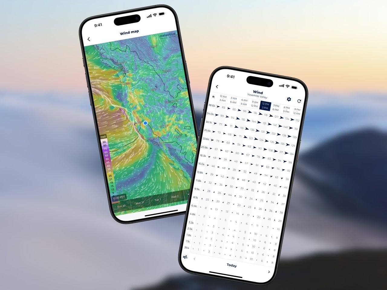
Wind aloft forecasts are critical for planning all types of flying activities, whether you’re a paraglider, skydiver, or drone pilot. Despite their importance, only a handful of apps provide wind forecasts for various altitudes. Not to mention, when they do, they are often poorly visualized and not very accessible.
Sonuby Weather offers a handy wind aloft chart as well as a wind map for winds at various altitudes. In this article, we’ll explore how to access the chart & map and how to configure Sonuby to be your personal flight planning tool.
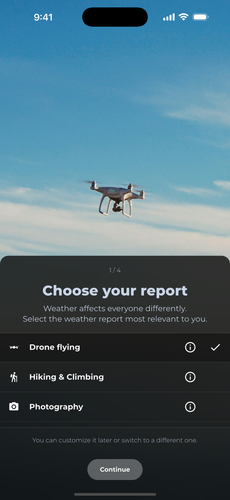
Weather report selection during onboarding.
In your particular case, wind aloft forecasts are relevant to you. But weather affects everyone differently. To account for the diversity of weather needs, Sonuby is built around the concept of weather reports. Each report is tailored to a specific activity or area of interest, such as Drone Flying, Skydiving, Sailing, and more.
Right after you have downloaded Sonuby, you will be prompted to choose your preferred weather report. This will determine which weather variables are displayed in the different forecast sections of the app.
For the purpose of this article, we will focus on the Drone Flying report, as it provides direct access to the wind aloft chart and map. However, the same features are available in other reports as well.
You can always switch between reports later on by opening the sidebar menu.
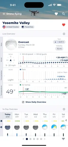
Long-tap current wind speed to open altitude wind forecast.
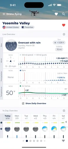
Once you have completed the onboarding process, you will see the Live Overview forecast module for the location you are currently viewing. The forecast variables shown are the ones most relevant to your selected weather report Drone Flying.
Each forecast module serves a different purpose. Live Overview shows weather conditions for the upcoming hours and is particularly useful for short-term decision making.
The pre-configured Live Overview for drone flying will show you the following information:
To access the wind aloft chart, long-press on the current wind speed visualization on the left, wait until a pop-up menu appears and select Altitude Forecast.
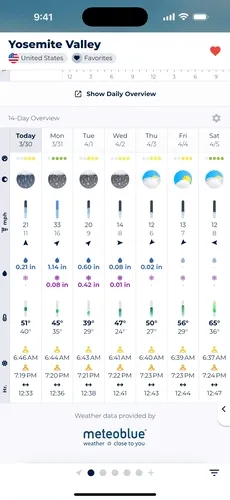
Long-tap on a day’s wind forecast to open winds aloft.
The 14-Day Overview forecast module provides long-term forecasts of up to 14 days for different weather variables.
For drone flying, the 14-Day Overview will show you the following information:
Similar to Live Overview you can long-press on the wind speed forecast for a specific day to access both wind aloft chart & map.
Tap the altitude button to open wind aloft forecast.
Both the Live Overview and 14-Day Overview modules provide a quick glance at the weather conditions. However, if you want to see more detailed information about the weather, you can access the Daily Overview.
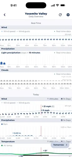
The Daily Overview provides a detailed breakdown of the weather conditions for a specific day. It shows all variables that have been pre-configured for your selected weather report.
Each variable is displayed as a chart, allowing you to see how the weather changes throughout the day.
To access the wind aloft chart from Daily Overview, you will have to scroll to the wind forecast chart. Above the chart to the right, you will see a button labeled Altitude Forecast. Tapping on it will open the wind aloft chart.
Swipe to see different days, switch to wind barbs.
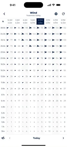
Once you have found your way to the wind aloft chart, you will see a full-screen visualization of wind speed and wind direction forecasts up to 11.8km (39,000 ft) for your selected location.
The chart shows the wind speed in your preferred unit (m/s, km/h, mph, bft, or knots) and the wind direction in degrees. The wind direction is shown as an arrow indicating which way the wind is blowing. Next to the arrow is the numeric wind speed.
Both the wind direction and wind speed are three-hour forecasts, as indicated by the time labels at the top of the chart.
Wind aloft forecasts are available for the upcoming 7 days. Swipe left or right to see the wind forecasts for different days.
If you are more familiar with wind barbs, you can switch to the wind barb view by tapping on the cog button in the top right corner of the screen.
Open wind map and switch to a different altitude.
If your activity takes place over a larger area, such as a paragliding trip into the mountains, you may want to see what the wind conditions are like over a larger area. In this case, the wind map is a great addition to the wind aloft chart.
Similar to the wind aloft chart, the wind map is accessible from Live Overview and 14-Day Overview. Simply long press on the wind forecast as described above and tap the Wind Map option on the pop-up menu.
In order to change the displayed altitude, tap on the cog button in the context menu to the side. This will open a settings menu wheren you can select the altitude you want to see. The wind map is available for altitudes up to 11.8km (39,000 ft).
The selected altitude will be remembered every time you open the wind map with your currently selected weather report.