Skydiving is a great sport for the brave at heart, but it does require a bit of preparation before you can take to the skies. Apps can help with things like keeping track of your gear, checking for the right weather conditions, or recording your jumps to see if you are making progress. Here’s a list of the top 4 must-have skydiving apps in 2026:
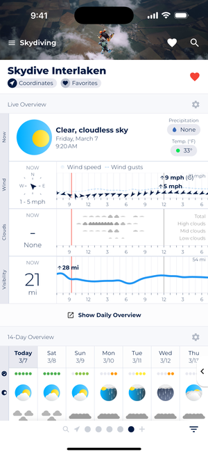
Quickly check if conditions are good for your next jump with the Live Overview and the 14-Day Overview.
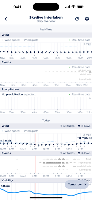
Daily Overview allows you to drill down to specific days and review conditions for specific days.
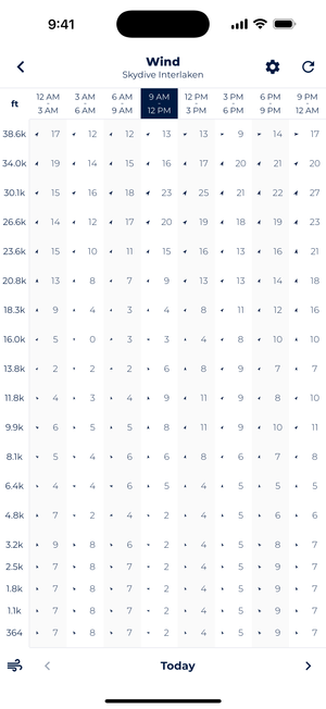
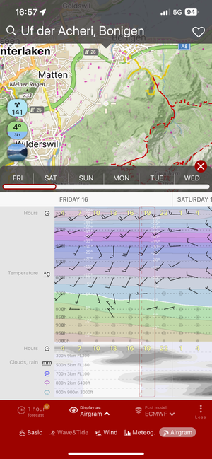
Altitude forecasts for wind, clouds, and temperature allow you to further prepare for your jumps.
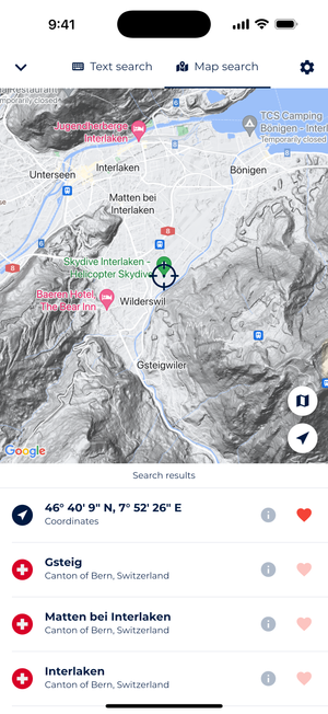
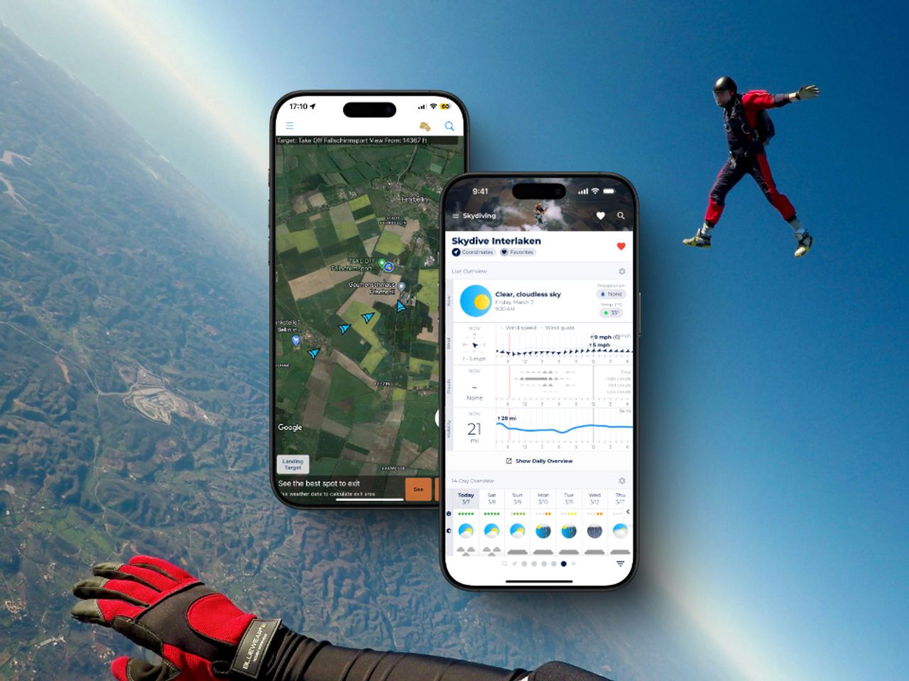
Map Search allows you to point to any drop zone on the face of the earth and see forecasts for it.
Sonuby is a weather forecast app designed specifically for enthusiasts like skydivers. It provides a weather report that shows the exact forecasts needed for skydiving.
The weather report consists of several forecast modules, such as a Live Overview, a 14-Day Overview forecast, as well as altitude forecasts for wind, clouds and temperature making it the perfect forecast tool to plan your next jump.
With it’s great map search tool, you can simply point to any drop zone on the face of the earth and get weather forecasts on the ground as well as altitude cloud cover, wind and temperature forecasts up to 38,600 ft.
The forecast data comes from the Swiss company meteoblue, known for its cutting-edge weather data. Meteoblue’s proprietary weather model selects from a variety of sources including nearby weather stations, observations and the best weather model (such as GFS, ECMWF and more) for the selected location.
Sonuby Weather combined with the great features of Spot Assist will allow you to be prepared for every jump.
Pros:
Cons:
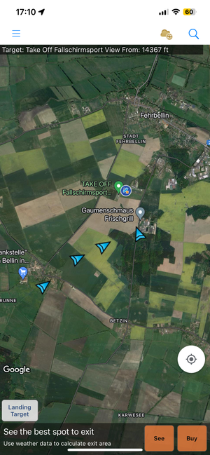
Spot Assist is one of the most popular apps for planning a skydive. It offers a drop zone database, has a great exit feature that tells you the best area to exit based on current wind conditions, as well as a flight pattern feature.
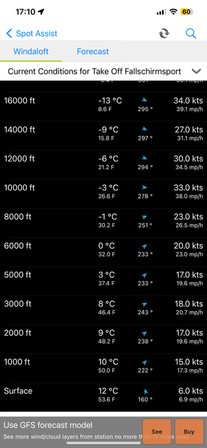
The app also provides skydiving weather forecasts, including current winds aloft and altitude forecasts up to 18,000 feet (paid subscription required). Forecasts such as ground winds, precipitation and more are available as three-day or seven-day forecasts (paid subscription required).
Pros:
Cons:
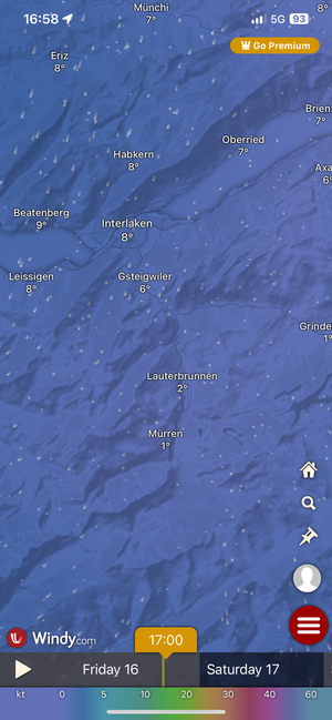
A weather app with one of the largest amounts of information, Windy offers great map visualizations for planning your jumps. There is also an altitude forecast map, which is a bit harder to find and rather small, especially on smaller devices, but gives a good overview.
A really great feature is the weather alert feature. You can create an alert for a selected location and tell it to remind you of certain wind conditions.
Overall, a great tool, but it feels like a chore to navigate around and the map-based view is not necessarily ideal for a quick overview.
Pros:
Cons:
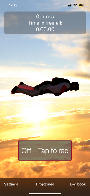
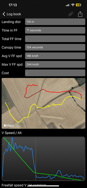
This is an excellent app for recording jumps and capturing a range of information about your journey to the ground. It tracks information such as time in free fall, exit and pull height, top vertical and horizontal speeds, and allows you to view your flight path on a map.
There are also features for signing your jumps, so there is no need to pass around a paper logbook. You can export your jump to JSON and kmz to view the jump in 3D in tools like Google Earth.
You can also turn on in-flight commentary that tells you your speed, glide ratio, and direction to the landing zone.
Pros:
Cons:
There are several excellent skydiving apps available, and any number of them can enhance your experience. Using an app can be a great way to put everything you need to check in one place, instead of listening to the radio for the weather and consulting the map for the best drop zone.
The apps on this list are the most useful, each with its own advantages and disadvantages. These apps are your best bet for significantly improving your skydiving experience. So check them out for yourself and see how they can help you improve your skydiving experience.