Storms can be powerful, or even frightening, and we usually take notice when they are at their full strength. But how do storms form, and what factors can make them more devastating and powerful?
Most storms have three stages: the cumulus, the mature, and the dissipating stage. They also require a few things to get started. If you think of storm formation as a recipe, these factors would be ingredients. We will cover each of these factors in detail, as well as use an example to explain each stage of storm formation.
The first stage of storm formation is when warm air moves upwards through the atmosphere as an updraft. This can happen for several reasons, but—so long as the other ingredients for storm formation are present—it usually has the same eventual result. [1]
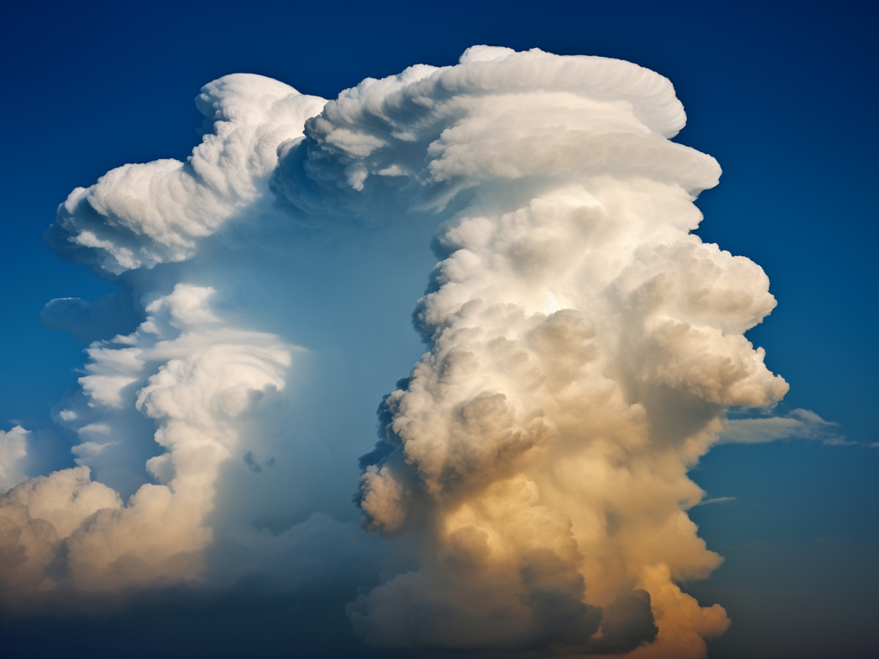
When the air reaches high enough in the atmosphere, it eventually cools and begins to form clouds. These clouds are called cumulus clouds and form when moisture in the rising air condenses. As long as the air below continues to be warmer than the air above, these clouds will continue to form. [1]
If you are interested in clouds and how they form, read my blog post about 3 Cloud Types You Should Know.
Some reasons for this updraft to form can include surface warming (where energy from the sun heats up air near the ground), or when air is forced up the side of a mountain, or even when opposing winds meet, and force one draft of air upwards. [1]
Whichever of these scenarios happens to create the warm updraft, three things need to be present to form a storm. These include moisture, atmospheric instability, and lift.

Moisture is fairly self-explanatory; there needs to be enough moisture in the form of water vapor in the rising air to form the necessary clouds to kickstart a storm. Sources of this moisture can include lakes, oceans, or even man-made reservoirs. [2]
Lift and atmospheric instability are a bit more difficult to tell apart. Lift as a concept is fairly simple, as it is when there is an external factor (like a mountain) to force the air upwards. This displaces the air into a new region of the atmosphere. Normally, in a stable atmosphere, this lift is only temporary, and the air will drop back into its normal position after passing over the lifting force. [3]
Atmospheric instability is a bit more complicated. This is the idea that once air has been lifted, it can either drop back into its usual altitude, or it can continue to climb upwards. You can think of this concept like a marble rolling in a bowl. Normally, if you put the marble on the side of an upright bowl, it will roll to the bottom and level out over time. However, if you were to flip that bowl and put the marble on the side, it would roll off down the sides and away. This inverted bowl symbolizes an unstable atmosphere. [4]
Simply put, in an unstable atmosphere, lifted air won’t drop back down after the initial force upwards. This is because the air above is colder than the air below, so the warm air that gets forced upwards continues upwards. As long as there is enough moisture in the rising air, you have all the ingredients to create a storm. [4]
An example of this process is when a storm forms over the ocean. In this case, the moisture is likely from the ocean’s surface heating, which creates humid, hot air that begins to rise. There may also be converging winds that create lift. And if the atmosphere is unstable, this lifting air could potentially trigger the formation of a storm.
The hot air will eventually reach a high enough altitude that it begins to cool, which starts to create clouds from water vapor. This is the start of the next stage in the storm formation process.
Cumulus clouds formed often resemble towers, and have a characteristic gray color from the heavy moisture. See if you can spot one next time there is a storm forecast in your area!
Once we have a cumulus cloud, the tiny water droplets formed within start to grow and cling to each other. Eventually, if the updraft continues for long enough, these droplets will get heavy and fall out of the sky. [1]
As the rain begins to fall from the clouds, it creates a cool flow of air pulling down towards the ground, called a downdraft. When we have an updraft and a downdraft in the same cloud, along with rain, we can call the cloud a cumulonimbus. This cycle of air rising and falling is also known as a thunderstorm cell. [1]
Throughout this stage, the downdraft created by rainfall, and the updraft created by lift are roughly balanced. As a result, the storm is able to sustain itself and grow in power.
The sliding of air alongside itself can also create an electrical charge within the cloud. When these electrostatic charges detonate, it creates a flash release of energy as heat, light, and sound. This is how thunder and lightning form. [1]
This is the stage of storm formation that most people think of when they think of a storm. You can have lots of different types of storms by altering this process very slightly. For instance, if it is very cold, the rain may begin to freeze, and create hail or snow.

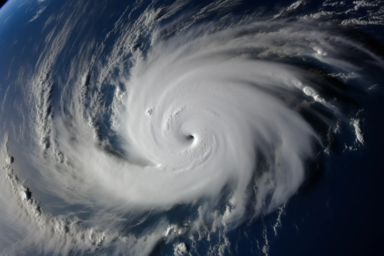
Storms are different when they form out at sea. This is because when the air rises and falls, it can create changes in pressure. Over a large enough area, and without the obstructions often found on land, the low-pressure areas will draw in very strong and fast winds. When over warm water like in a tropical area, there is additional moisture being sucked into the already existing storm. With to the Coriolis effect, these winds can then be forced to swirl around to form the characteristic rotating winds of a hurricane. [5]
The final stage of a thunderstorm begins when the downdrafts caused by rainfall overwhelm the updrafts of warm air. Because this warm air is what brings the moisture needed for cloud formation to bring rain, the storm eventually dies out with lighter rain as the cloud begins to disappear. The cooling action of the rain also stabilizes the atmosphere, so the storm can’t continue forming. [1]
When out at sea, the warm sea surface is likely what has given the air both lift and moisture (two of our “ingredients” of storm formation). Thus, when the cold rain falls and cools the sea surface, the warm air can no longer be lifted upwards to create updrafts, and the storm will dissipate. Most storm cells have a lifespan of roughly sixty minutes. [1]
However, some storms can be much more intense, and take several hours or even days to peter out. These intense or severe storms usually grow from a single thunderstorm cell, and get larger when intensifying factors are present. A single storm cell can also develop into a multicell storm if the winds that cause the storm are strong enough. [6]
Multicell storms are groups of thunderstorm cells, which are all at different stages of life. As one grows, it can influence neighboring sections of air to be displaced, and start the process of storm formation all over again, keeping the storm going. [6]

To create a multicell or supercell storm, there needs to be intensifying factors associated with strengthening the storm. These factors can also just create more violent single-cell storms with low-velocity winds.
Forecasting thunderstorms with any degree of accuracy is difficult. This is because small differences in the predicted temperature, wind speed, or amount of rain can cause large differences in the formation and development of a storm.
However, if you want to chase thunderstorms, it’s best to do so with a constantly updated forecast. The closer it gets to the time of interest, the more likely you are to get a reliable forecast.

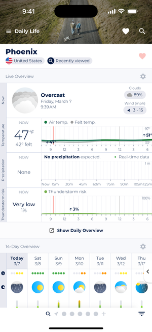
Sonuby’s Live Overview can be configured to display current thunderstorm risk, helping you track developing conditions that could lead to storms in your area.

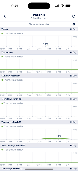
The 7-day thunderstorm risk forecast shows potential storm development throughout the week, allowing you to plan ahead for possible severe weather events.
One way to predict storms is to look at the pictograms shown in Sonuby’s hourly forecast, which is available in the “Daily Life” weather report. It will show you towering cumulus clouds and possibly lightning icons if there’s a chance of a possible storm (screenshot 1).
While not designed to predict storms, the radar map can also help you predict impending severe weather. Look for heavy rain and possible hail to predict events close to the current time (screenshot 2).
In a future version of the app, there will also be more data like Lifted Index (LI) and CAPE (Convective Available Potential Energy) to evaluate the likelihood of storm formation.
Resources:
[1] scied.ucar.edu
[2] www.weather.gov
[3] www.rmets.org
[4] pressbooks-dev.oer.hawaii.edu
[5] nhmu.utah.edu
[7] gpm.nasa.gov
[9] www.edf.org